An Aerial Photographic survey is an invaluable tool for assessing a building’s current structural condition. Early assessment can save thousands of pounds, by identifying and addressing issues before they become more costly later down the line.
Commission Air is the Country’s leading provider of detailed condition survey photography. Using helicopters nationwide, we are uniquely equipped with the ideal platform and experienced crews, specialising in this type of work.
Using a helicopter with a photographer is without doubt, the best way to carry out these types of surveys. Drones are too slow, need a two-man ground crew and access permissions. From our helicopter, we can remotely handle the whole of your building portfolio, easily moving from one site to the next, we can deliver the results on time and within budget. Using our 50 million pixel camera, we produce images so detailed you can zoom right in to see cracks in tiles, walls and windows, problems with flat roof areas and ground conditions etc. Our high resolution Aerial Photography provides you with visual data reducing the need for site visits, and provides a permanent record for historical reference. Also, all of our images contain valuable GPS data allowing you to see the precise location from where the photo was taken.
For over 30 years, we have carried out Building surveys across the country for both the private and public sectors. For example, during the past ten years, we have photographed thousands of schools as part of a nationwide condition survey programme. We have also worked with the Warwickshire and Shropshire NHS Trusts, surveying buildings in their respective property portfolios.
Depending on numbers, the cost for each site could be as little as £115. You will receive a minimum of 30 images including a vertical plan shot and the rest, close ups of the buildings, from different directions all around the site.
An initial aerial survey by Commission Air will provide you with the most efficient and cost-effective method to assist with your next condition survey programme.
See the superb quality in our images below.
Zoom in by using the mouse wheel to see it on detail
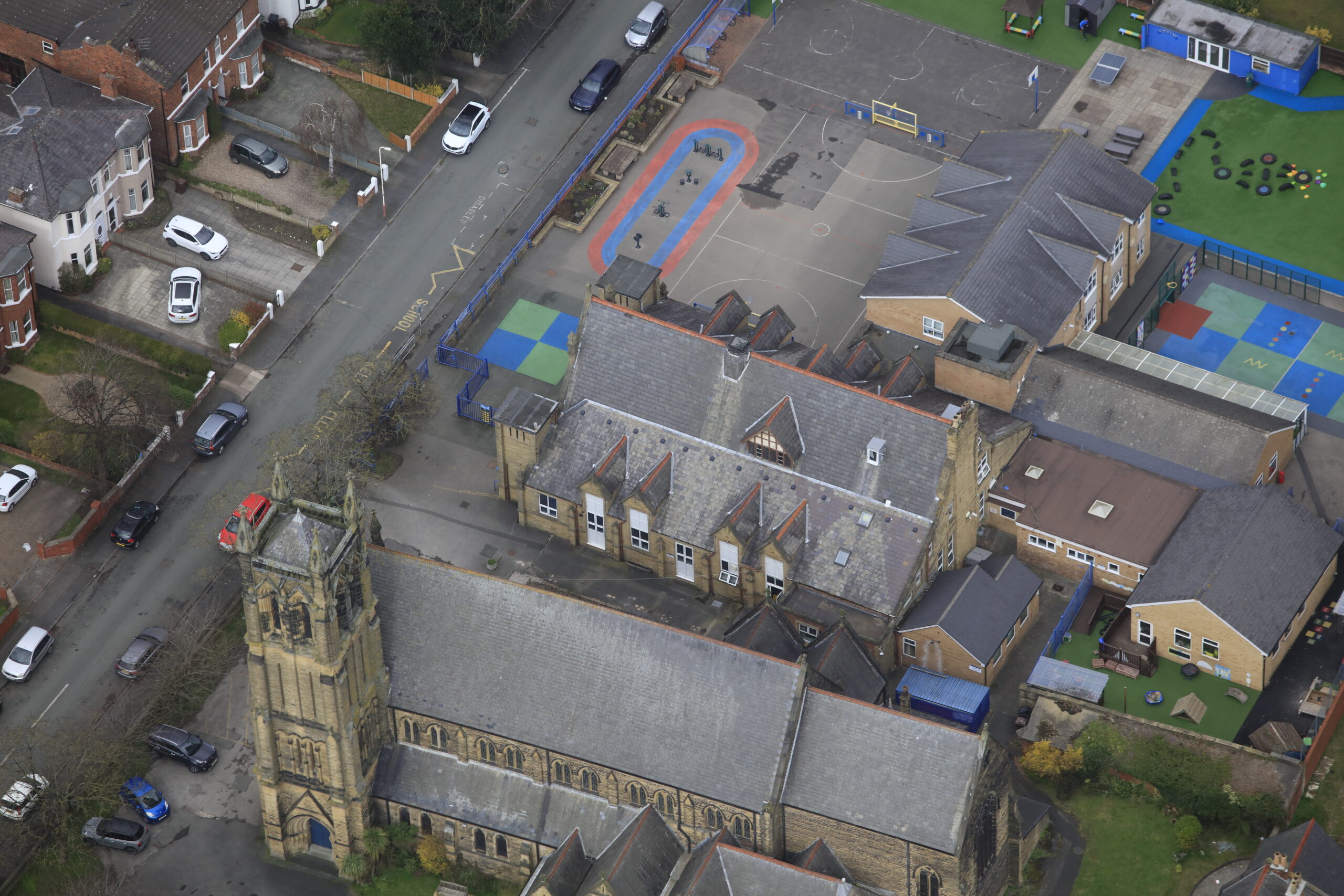
Original Image Taken From Our Helicopter

Zoomed In Image To See The Detail And Identify Any Problem Areas